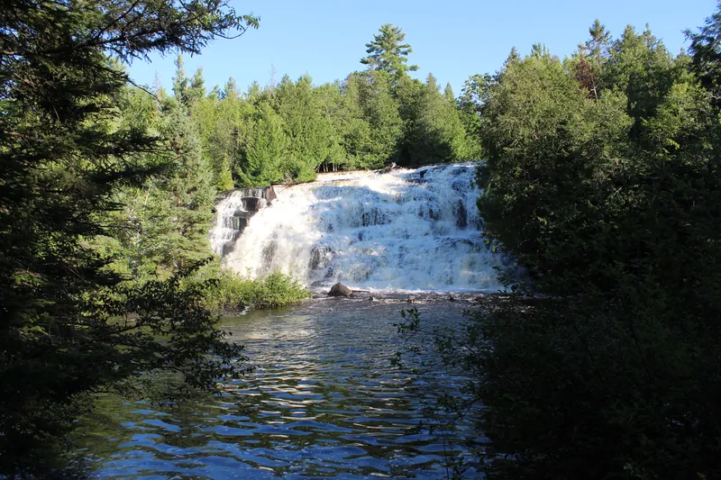
Bond Falls is a scenic site in southern Ontonagon County, surrounded by Ottawa National Forest though it is not inside the forest boundary. The Michigan DNR and the Forest Service both treat it as one of the Upper Peninsula's most visited falls. 12
What to see
The DNR says the falls form as the Middle Branch of the Ontonagon River tumbles over a thick belt of fractured rock and splits into many small cascades. The total drop is about 50 feet. An accessible boardwalk with six viewing locations, roadside parking and picnic tables sit at the site. 1
The Forest Service notes that Upper Peninsula Power Company manages the top of the falls and the DNR manages the bottom. A developed trail with steps and bridges crosses the river at the base. 23 The Forest Service also says this is a fall that holds up year-round. 2
Best seasons
The DNR typically opens the site to vehicles from mid-May through mid-October, weather allowing. The hiking trail stays open all year; the DNR is plain that trails and boardwalks are not monitored or groomed for snow and ice. 1 The lower parking lot is seasonal and closes in winter. 2 Winter here is a walk in, not a groomed ski trail. Those notes sit with the other waterfall winters on our Winter page.
How to get there
The DNR lists the site at 46.409771, -89.134757. 1 The Forest Service's driving note is US-45 north from Watersmeet to Paulding, then right on Bond Falls Road. 2 A Recreation Passport is required to enter the falls area from the bottom parking lot. 24
Tips
- Walk the boardwalk's six viewing spots. The DNR built them so the fractured ledge reads as one fall, not a single overlook. 1
- The other UP waterfall pages we keep are Tahquamenon Falls, Munising Falls and Black River Harbor. Porcupine Mountains is the next ridge west.
- The Tahquamenon ornament and coaster set are the waterfall pieces we print.
Safety
Fast water at the brink and winter ice on an ungroomed boardwalk are the hazards here. This page does not report today's flow or whether the lower lot is open. Check the Bond Falls Scenic Site page before you go. 1